A growing portfolio
of projects.
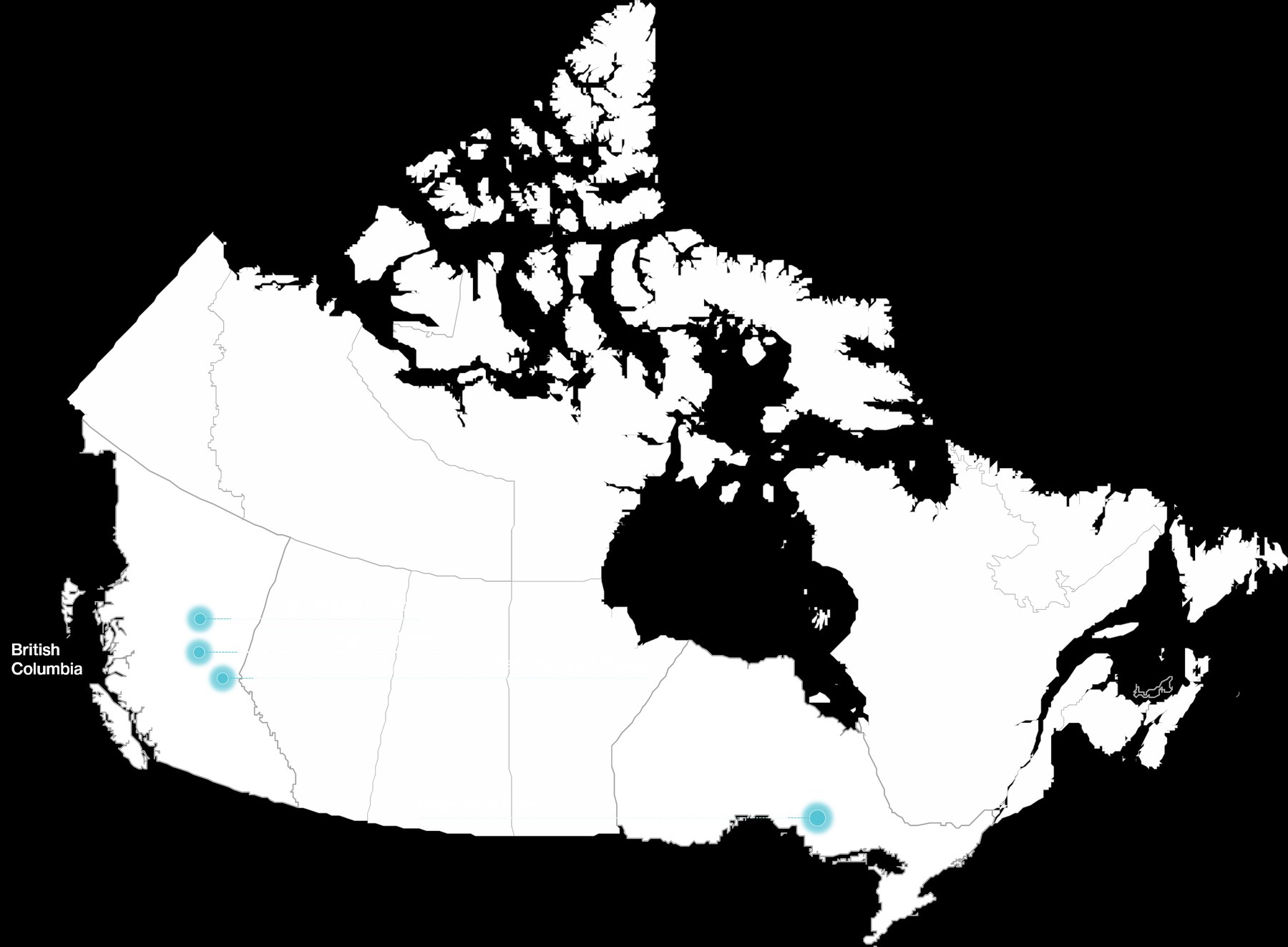
Maple Birch
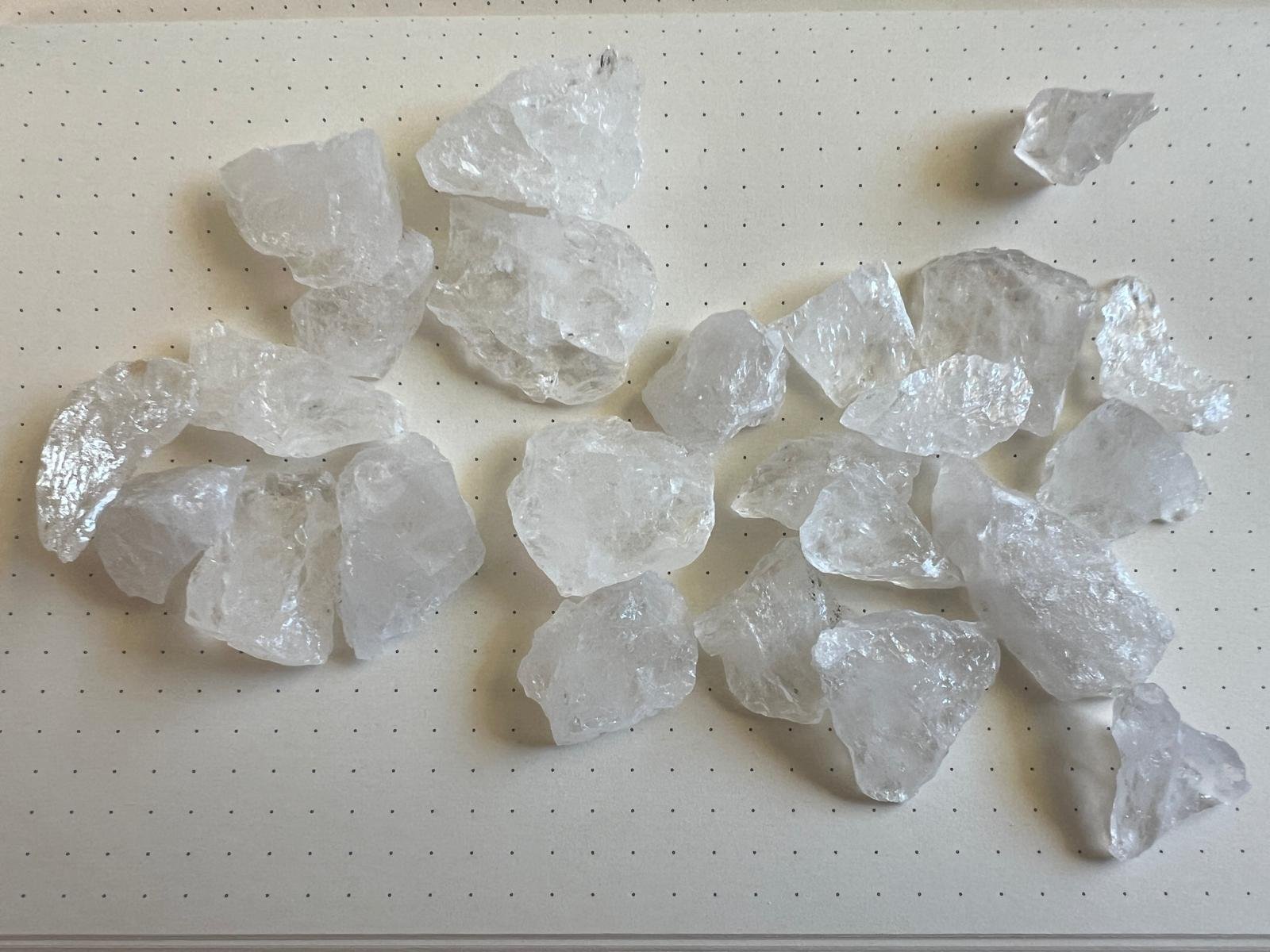
30 MIN FROM SUDBURY · ONTARIOPermitted · ProductionA high purity, quartz-rich pegmatite deposit analogous to Spruce Pine in North Carolina. The property covers more than 1,800 hectares of underexplored claims and includes a permitted production quarry. Material from the quarry has assayed at >99% SiO₂ with low Fe/Ti, and has previously sold for up to US$1,000 per tonne. Road accessible, 30 minutes from Sudbury, with rail and Great Lakes connectivity to global markets.

Ptarmigan
CARIBOO MINING DIVISION · BCDrill & bulk-sample permitA high-purity quartzite project located approximately 130 km from Prince George, British Columbia. Preliminary 3D modelling using Civil3D and LiDAR indicates approximately 5 million m³ of quartzite material at surface, present as topographic high ridges (density ~2.6 t/m³). Subject of an NI 43-101 Technical Report (Healex Consulting, Sep 2024). A 5-year Notice of Work drill and bulk-sample permit was acquired in Q3 2025.
Crystal Hills
40 KM N OF NORTH BAY · ONTARIOExplorationA district-scale claim package: five mineral claims comprised of eighteen cells totalling approximately 400 hectares, held at 100% interest. Prospective for high purity silica in a well-established Ontario mining jurisdiction.

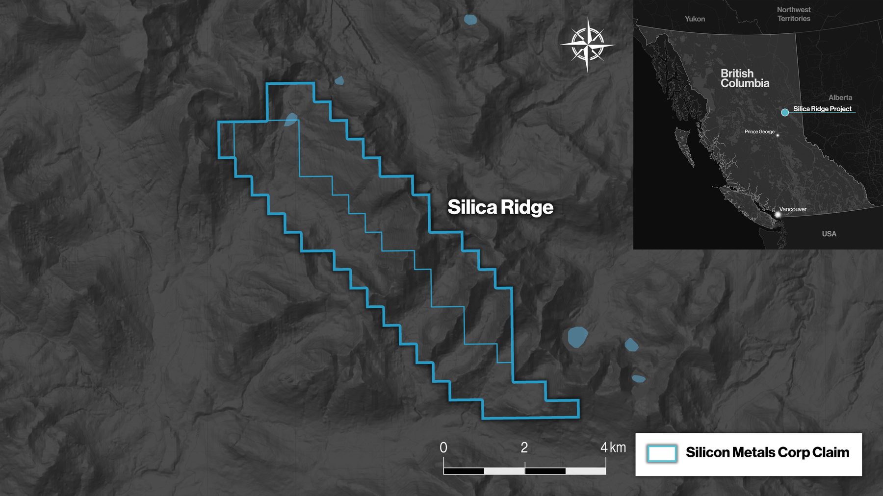
Silica Ridge
70 KM SW OF MACKENZIE · BCExplorationA 2,538-hectare property hosting a significant quartzite occurrence with high-purity silica. Five drill holes completed by Silver Standard Mines Ltd. in 1975 reported a substantial tonnage of silica with SiO₂ at 99.43%, Fe₂O₃ 0.09%, Al₂O₃ 0.08%, CaO 0.011%, and LOI 0.18% (BC government Property File PF016434.pdf). Strong expansion potential to the southeast supported by recent regional mapping.
Longworth
85 KM E OF PRINCE GEORGE · BCExplorationA 3,863-hectare property targeting the Nonda Quartzite formation along Bearpaw Ridge. BC Geological Survey samples collected in 1982 averaged 99.5% SiO₂. Four northwest-trending quartzite bands have been mapped, with thickness up to 400 metres. Significant potential for expansion along strike, complementing the BC project footprint.
